With the development of UAV and digital camera technology, UAV aerial survey technology has played a unique advantage. The combination of UAV and aerial photogrammetry makes UAV digital low-altitude remote sensing a new development in the field of aerial remote sensing and direction.
drone aerial photography, also known as “aerial photography”, refers to the method of photographing ground or air targets from the air with an aerial camera installed on an aircraft. Drone aerial survey is an effective supplement to traditional aerial photogrammetry. It has the characteristics of flexibility, high efficiency, fast speed, low operating cost, short production cycle and wide application range. It can also quickly acquire high-resolution images in narrow and difficult-to-fly areas Classify according to the tilt angle of the photos (the tilt angle of the photos is the angle between the main optical axis of the aerial photography and the vertical of the ground line (main vertical line) passing through the center of the lens can be divided into vertical photography and oblique photography.
drone aerial photography, also known as “aerial photography”, refers to the method of photographing ground or air targets from the air with an aerial camera installed on an aircraft. Drone aerial survey is an effective supplement to traditional aerial photogrammetry. It has the characteristics of flexibility, high efficiency, fast speed, low operating cost, short production cycle and wide application range. It can also quickly acquire high-resolution images in narrow and difficult-to-fly areas Classify according to the tilt angle of the photos (the tilt angle of the photos is the angle between the main optical axis of the aerial photography and the vertical of the ground line (main vertical line) passing through the center of the lens can be divided into vertical photography and oblique photography.
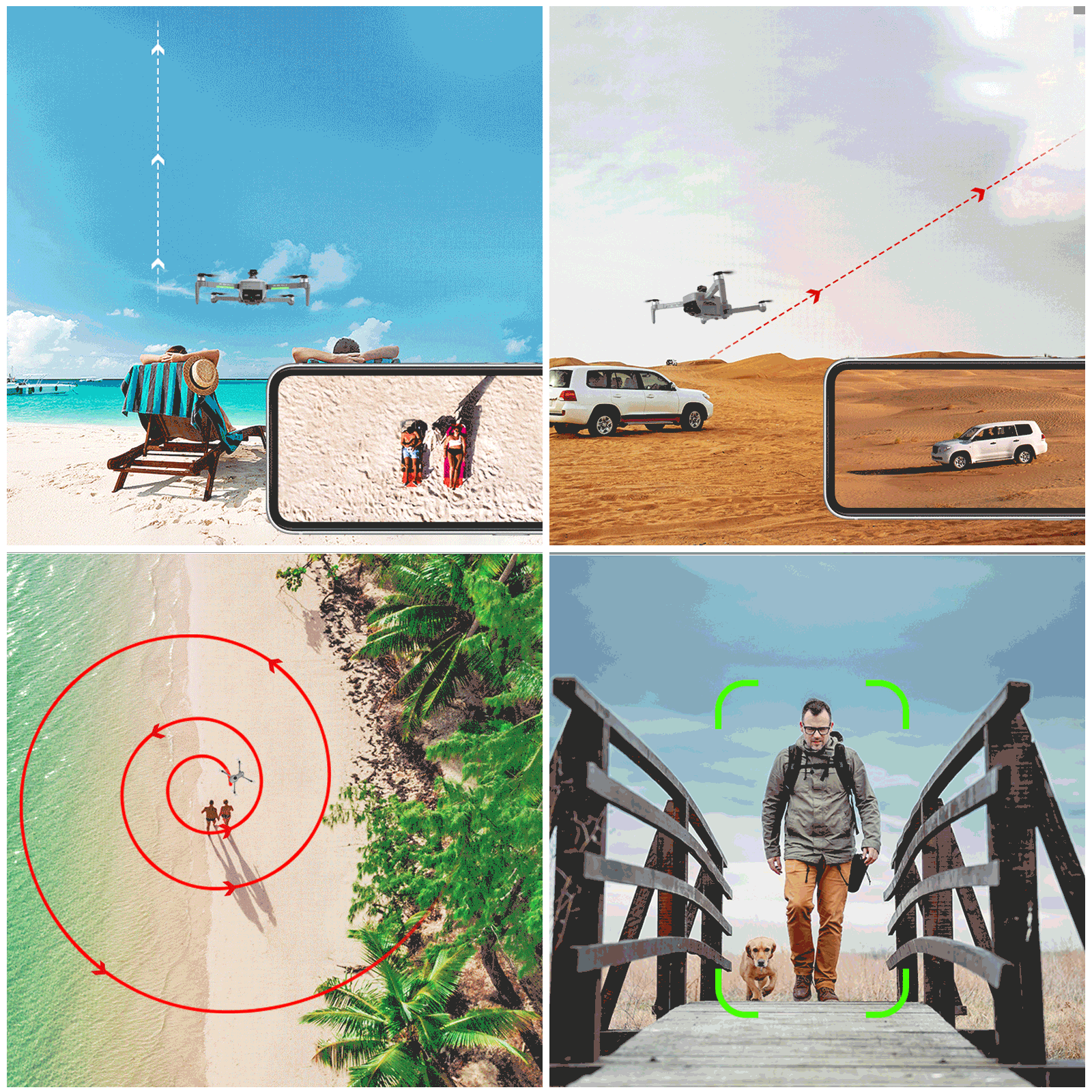
Airway photography: Continuously photograph the narrow and long areas of the ground or linear features (railways, roads, etc.) along the flight path, called airway photography.In order to connect the ground objects of adjacent photos and meet the needs of stereo observation, there needs to be a certain overlap between adjacent photos, which is called heading overlap.The heading overlap should usually reach 60%, at least not less than 53%. so can choose the drone With fixed-point surround shooting function.
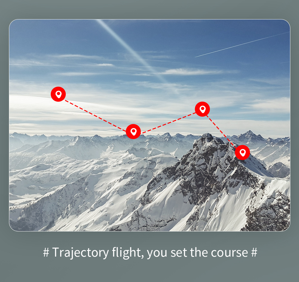
Area photography: Continuous photography of a larger area along several routes is called area photography (or area photography).The heading overlap between adjacent photos on the same flight path was 60-53%.Photos between adjacent routes also have a certain overlap, called horizontal overlap, which should generally be 30-15%.When implementing area photography, it is usually required that the flight route is parallel to the parallel line, that is, flying in the east-west direction.But sometimes it flies on the designed course.Due to unavoidable deviations in flight, the length of the route needs to be limited, ensure no yaw and avoid missed shots.
Aerial photography and UAV aerial survey generally choose the morning or afternoon, because the ground scenery is clearer in the morning or afternoon, the light is sufficient, and it is easy to obtain a better color tone effect. In addition, in the process of drone aerial survey and shooting, it is also necessary to pay attention to the four major elements of altitude, terrain, wind force and direction, and electromagnetic lightning.
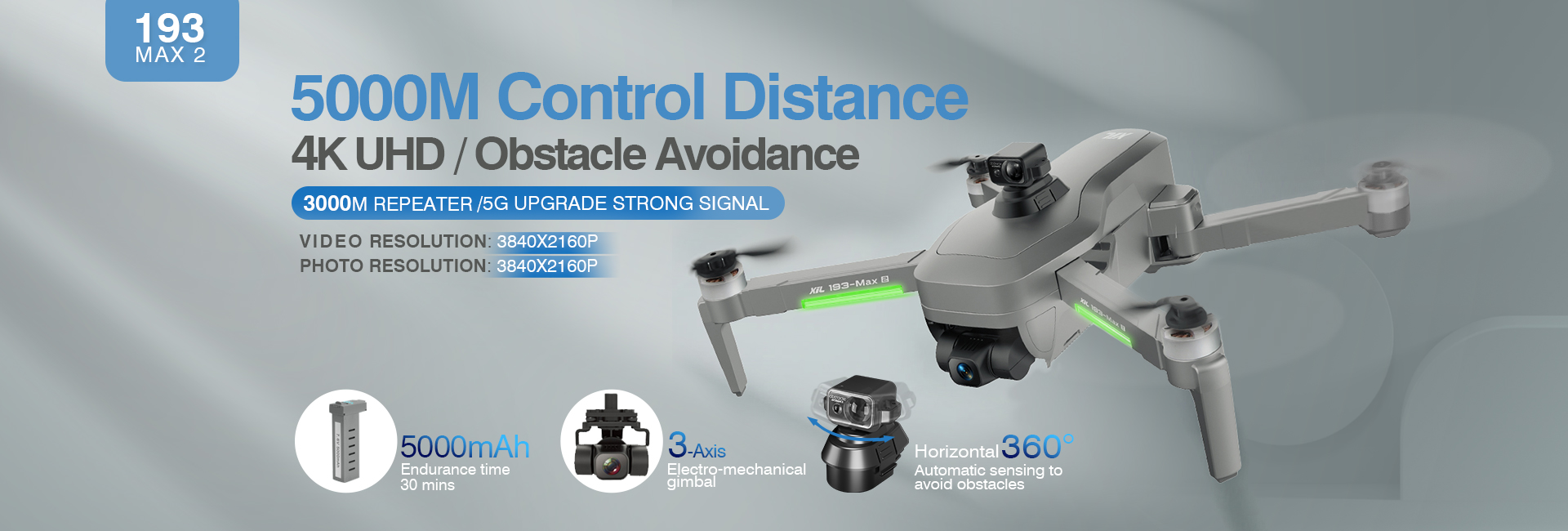
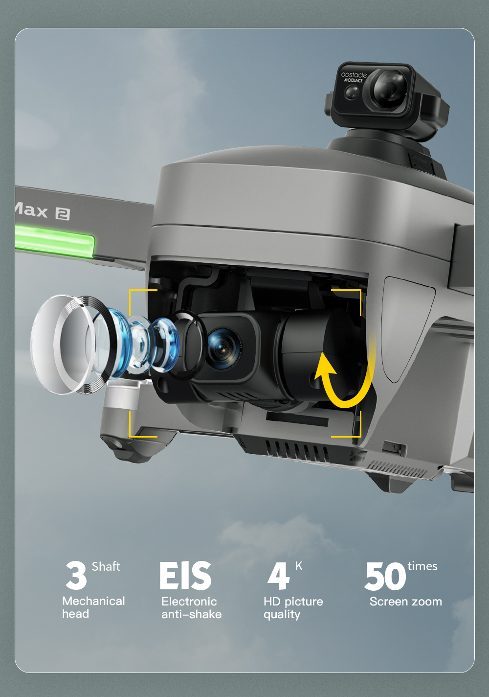
Now we offer our latest ultra 4K drone with 2-axis laser camera 560-degree obstacle avoidance, reachable avoidance velocity 10m/s, Intelligent obstacle sensing distance about 20 meters. Click the link for more drone information. We have an excellent design team, support customized logo, packaging, color design, please feel free to contact us for more information.
Post time: Dec-12-2022